The Real Eco State allies with NASA to research Chilean Patagonia
The scientific initiative targets the measurement of the data in remote zones not properly covered by satellites.
The Chilean company, The Real Eco State, that exclusively specializes in marketing land for conservation purposes in Chilean Patagonia, has partnered the mission that NASA and the University of Maryland have been working on for four years to map large green areas on the planet and calculate accurately the carbon sequestration they perform.
The mission Global Ecosystem Dynamics Investigation (GEDI) that started in 2018 uses LIDIAR technology, which employs the physical properties of light to estimate the height of any natural or artificial objects to shoot laser rays toward the terrestrial surface. These rays are controlled by the International Space Station and have been catching the first high-resolution images of the Earth’s 3D structure.
According to the first obtained results, Chilean Patagonia´s 45 million hectares would capture carbon emissions equivalent to 15 million Chileans each year.
ITS FUNCTION
This process allows accurate measurements of the height of forests, their structure, and the surface of elevation, thus substantially improving the capacity of defining crucial carbon and water cycle processes and quantifying the biodiversity of trees in an area and surrounding habitat.
In simple words, both an inventory of large geographical extensions to sequester carbon and other forest parameters have been worked on remotely. That is why NASA has focused on large forest extensions on our planet; For NASA and the University of Maryland, Patagonia, one of the largest green areas, represents one of their project interest spots.
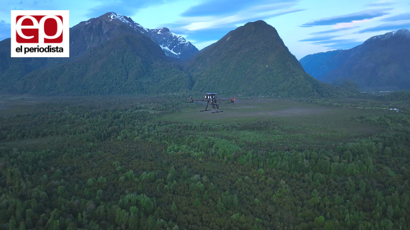
Laser rays have been shooting from space to that zone since 2019, which generate computing models over the base route they go across. However, the end of the GEDI project was forecasted by this month; as a result, this part of the planet wouldn’t be covered before this time. The incorporation of The Real Eco State and WEConserve, a non-profit foundation whose mission is land conservation and the generation of scientific knowledge about it, made the extension of this project possible without employing satellites.
Both institutions started to run a specialized drone with LIDAR technology in Patagonia, which can release accurate data necessary to measure the information of GEDI in remote zones where satellites could not cover them correctly.
In Taryn Fuentes’s and Aaron Grau’s words, expert members of the foundation WEConserv, “It has always been a challenge for science to estimate the carbon sequestration of large extensions of forests around the Earth; therefore, this mission intends to resolve that. We are highly proud of collaborating with NASA and the University of Maryland by obtaining accurate data through a specialized drone which is helpful for GEDI to validate its estimations in Patagonian forests, one of the largest green areas on this planet”.
THE PROJECT COURSE
While NASA and the University of Maryland are carrying out more refined data processing, collaborative work is obtaining what may be called a more accurate estimation of how Patagonia helps the planet regenerate.
According to WEConserv’s projections, each hectare of Patagonian forests sequesters an average of 105 tons of carbon, equivalent to what 35 people generate each year; thus, Chilean Patagonia´s 45 million hectares would capture carbon emissions equivalent to 15 million Chileans yearly.
The founder and CEO of The Real Eco State, Felipe Escalona, explains that the creation of this scientific information will allow all people who have invested or wanted to do so to conserve Patagonia by building small private conservation parks, exactly know how much carbon their plot of land sequesters and even take part of the carbon credit market, encouraging the private conservation of our unspoiled Patagonia”.
Source: El Periodista